
QUAINT’s map of the month/1: Highway flows and tolling sistems per section – year 2015
 On the website of the research project QUAINT (Quantitative Analysis of Italian National Transport) [bando SIR. Project protocol: RBSI14JR1Z] today opens the new section:
web-Atlas of Italian Transport
It includes a collection of infographics that explain the Italian transport system, in all of its aspects: infrastructure, services, demand and territory. Infographics will be published monthly and included in the TRASPOL newsletter.
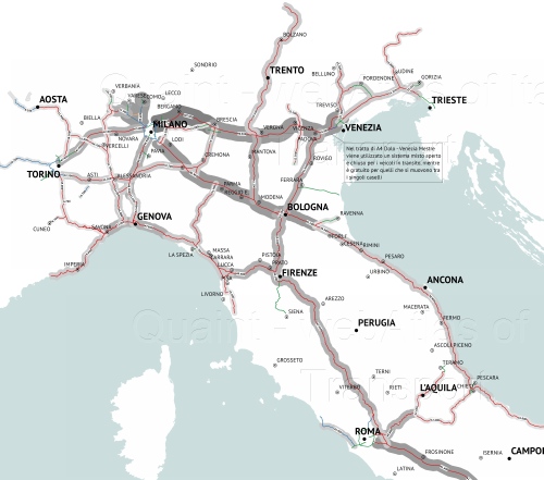
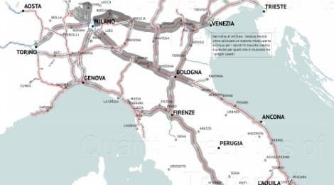
In the meantime of the offical presentation of the Atlas and of its contents, here you the first map visualising the highway flows in Italy in 2015 and the different tolling systems. You can navigate high-resolution maps or download them.
Visit the page of the web-Atlas: http://www.quaint.polimi.it/atlante