The research programme QUAINT A comprehensive tool for the quantitative analysis of Italian national transport plans and policies, is funded by the Italian Ministry of Research (MIUR) within the excellency programme SIR [Project protocol: RBSI14JR1Z]. QUAINT’s goals are to:
- CREATE a unique database of all Italian long distance transport components (infrastructure, services, market conditions, demand)
- DEVELOP a quantitative and spatial tool for the analysis of passenger long distance transport plans and policies and at the national level (I-TraM)
- STUDY the long-distance mobility in its components of systematic and occasional trips
- MAP in a Tematic Atlas of Italian Transport the geography of the system and the possible effect of future policies
- EVALUATE a broad range of projects, plans and policies, from the point of view environmental, from the enviromnental, economic and territorial viewpoint.
Transport planning at any scale is commonly based, in many countries, on a deep knowledge of the current demand and of all dimensions of supply (infrastructure, services and market conditions). However, in Italy, the national scale of transport is barely known and decisions are not based on quantitative data and supported by comprehensive simulations of alternatives.The QUAINT research project aims at filling this gap.
The project is made of three parts.
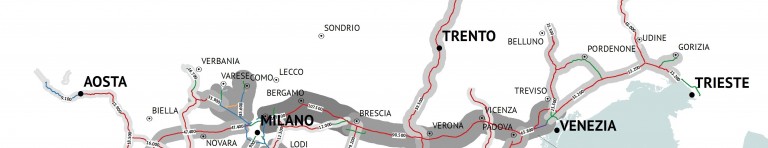
A first part is dedicated to the creation of the database. This involves the geo-referencing of infrastructure networks complemented by descriptive information; the creation of a multimodal hyper-graph of paths and timetables for air, rail, coaches and ferry services; the analysis of market conditions and fares structure through web crawlers and statistical elaborations; the collection of available demand figures. The first outcome of the project will be a web-Atlas of Italian transport and also a traditional paper version (Atlante dei trasporti italiani. Infrastrutture, offerta, domanda) published by Libreria Geografica.
The second part is related to the modeling, of the system, as a policy-simulation tool. The database will be interfaced with a commercial 4-steps model software and used to calculate the generalized costs, to estimate an Origin – Destination long distance passengers matrix (integrating existing observations and sources and simulated data), to estimate the modal split, to assign the network.
Finally, the third part will be devoted to the simulation of scenarios and policy packages. This implies the preliminary definition of the scenarios, made of exogenous variables (e.g. oil cost), endogenous (taxation levels, pricing scenarios, etc.) and transport supply (different network configurations and different long distance public transport supply). The scenarios will be simulated and assessed in terms of environmental impact (emissions, noise, climate change, etc.), socio-economic efficiency (cost benefit analysis) and distributive aspects.
The innovations and impacts of the project are of different nature. Firstly, the project will build a comprehensive and huge database of transport sector, currently not existing in Italy. Secondly, a forefront tool for the detailed spatial analysis and assessment will be developed and used for the analysis of scenarios, plans and policies. In addition, numerous specific methodological innovations will be introduced: the construction of a multimodal timetables based hyper-graph, the direct connection between simulation model and economic assessment, the use of data mining techniques for market structure analysis, etc. Ultimately, the most interesting impact of the project lays in creating an independent tool to ground the public debate and possibly support transport knowledge and decisions.
SITO DEL PROGETTO: