
QUAINT’s map of the month/6: Direct connections (railway and long distance coaches) from Bari and Genova
 On the website of the research project QUAINT (Quantitative Analysis of Italian National Transport) [bando SIR. Protocollo progetto: RBSI14JR1Z] the publication of the
Web Atlante dei trasporti italiani
goes on. It is a detailed collection of infographics that illustrate the Italian transport system considering all of its features: infrastructure, services, demand, territory. Infographics are included in the TRASPOL newsletter.
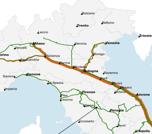
The sixth map displays the direct connections from Genova and Bari by the railway network and long distance coaches. The maps are navigable in high resolution and can be downloaded.
You can find more maps on the Italian transport system in the recently published Atlante dei Trasporti Italiani
Offical page of Web ATLANTE: http://www.quaint.polimi.it/atlante